


Tropical Storm Arthur, the initial named storm of the 2026 Atlantic hurricane season, is currently skirting the Texas Gulf Coast and is anticipated to reach the southwest Louisiana coastline later tonight. Meteorologists are warning of a significant shield of tropical moisture accompanying the storm, which they deem more hazardous than the wind itself.
Arthur Emerges as a Defined Storm
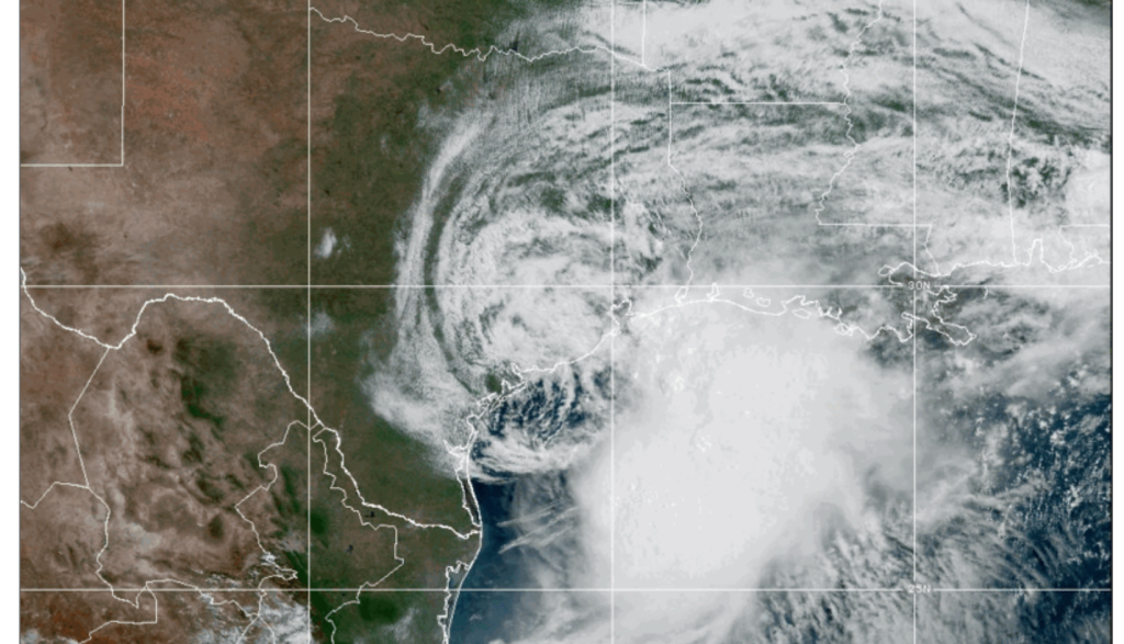
The National Hurricane Center officially designated Arthur as a tropical storm on Wednesday morning, noting maximum sustained winds of 40 mph. A wind gust of 48 mph was recorded in Galveston recently.
Arthur’s center is currently moving northeast along the upper Texas coast, with a projected turn inland over southwestern Louisiana by tonight, making landfall near Lake Charles around sunset before weakening rapidly inland.
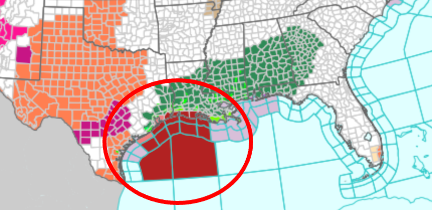
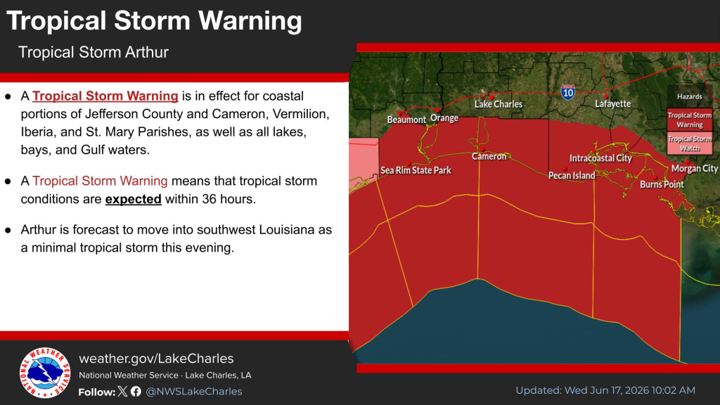
Tropical Storm Warnings are currently in place from High Island, Texas to Morgan City, Louisiana. Coastal areas affected include Cameron, Creole, Grand Chenier, Johnson Bayou, Holly Beach, Hackberry, Abbeville, Intracoastal City, Avery Island, Nederland, Port Arthur, and Sabine Pass.
Primary Concern: Flooding
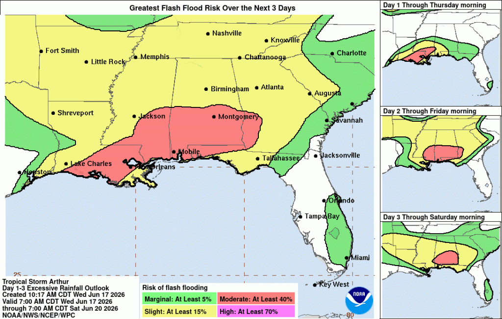
Contrary to popular belief, wind is not the primary threat posed by Arthur; it is the potential for widespread flooding. Predictions indicate that Arthur could unleash between 5 to 10 inches of rainfall in parts of Texas, Louisiana, Mississippi, and Alabama, as well as western sections of the Florida Panhandle, as reported by CBS News. The most severe projections by NOLA.com suggest rainfall totals nearing 15 to 20 inches in areas like Baton Rouge, Acadiana, and the northshore, which could result in catastrophic flooding.
Flood Watches have been issued by the NHC for all coastal Louisiana parishes under a Tropical Storm Warning, with experts warning that substantial rainfall could lead to widespread evacuations and rescues, as well as rapid overflowing of rivers and tributaries in various locations.
Expected Storm Surge: 2 to 4 Feet in Coastal Regions
Coastal areas are bracing for a potential storm surge of 2 to 4 feet above ground level in regions like East and West Cameron parishes, Lower Vermilion, Lower Jefferson (Texas), and Lower St. Mary Parish. The NHC has highlighted the presence of “lifethreatening surf and rip current conditions along the northwestern Gulf Coast” and cautioned that the most significant water levels will be seen east of the landfall site. Offshore, southwest winds ranging from 30 to 35 knots and seas of 8 to 11 feet are anticipated today, prompting maritime authorities to advise against venturing out to sea until conditions improve.
Possibility of Tornadoes
Both the NHC and NWS Lake Charles have highlighted an increased risk of tornadoes within the warning area, particularly in the outer rain bands that typically spawn tornadoes ahead of a tropical storm’s landfall. Residents in Arthur’s path are advised to be prepared to seek shelter promptly in the event of tornado activity.
For individuals located in evacuation zones with official orders, immediate evacuation is strongly recommended. Stay updated with the latest information from the National Hurricane Center. Arthur marks the first named storm of the 2026 Atlantic season, which extends until November 30.